Here’s another great set of navigation tips from our friend Capt. John of skippertips.com…
Make a sailing landfall with confidence when you tap into the secret of elevation contours. Set sail to an island in the warm waters of the Caribbean with confidence. Calculate the time that you might sight a lofty peak in the Pacific or Atlantic. Add these vital chart symbols to your sailing navigation “goldmine of knowledge” now!
Think of land elevation contours like those found in water–depth contours. Cartographers will sometimes indicate the height of a contour prominent enough to be sighted by a mariner. Heights will be shown as a number, so always check the chart datum to understand the height value. It could be in feet or meters. Make this your first step so that you know at-a-glance what the height values indicate.
1. Why Stagger Contour Lines Elevations?
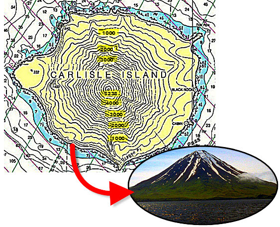
Contour height values can be shown for each individual elevation or they may be staggered. We have highlighted these staggered contour values in yellow so that they stand out. Use similar annotations on your own nautical charts or plotter to make sailing navigation symbols easier to see. Notice how the cartographers have used a bold typeface on specific contours to help them stand out. This adds clarity and makes sailing navigation easier on the eyes. (Photo courtesy of Wikipedia).
2. Look for These “Spot Heights” of Navigation Gold!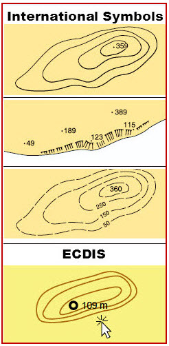
If you recall in previous articles, just those specific aids with a high degree of survey position accuracy receive a black dot, called a “spot height”.
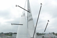
Note the spot heights that show mountain peaks on the first two illustrations to the right. Use these gold mines for lines of position, radar targets for circles of positions, or waypoints to help you confirm landfall on any coastline.
Exercise caution with any chart symbol that shows broken contour lines (third illustration). Dashed, broken lines mean “approximate” or incomplete survey. Use solid, unbroken lines for more reliability.
3. Electronic Displays of Contours.
Big ships like tankers and freighters will often have electronic charts that comply with the Electronic Chart Display Information System (ECDIS). ECDIS compliant electronic chart symbols represent the highest standards in the industry.
Find all ECDIS symbols and abbreviations in the latest free edition of US Chart No. 1: Symbols, Abbreviations and Terms Used on Paper and Electronic Navigational Charts. You can download a free copy of this nautical treasure from the National Geo-Spatial Intelligence Agency (NGA) Chart No. 1 (12th Ed.)
Electronic symbols used on recreation vessel displays may be different than those used aboard commercial vessels. Check your electronic chart plotter manual to find out those specific symbols used by your manufacturer.
In the lower illustration, you see the ECDIS compliant electronic display of elevation contours along with a sample spot height (109 meters).
Move the cursor over or near the spot and the height will display as shown. Also notice that the symbol for the spot height appears as a small circle with a bold outline (nautical charts always display a single dot for spot heights).
~~~~~~~~~~~~~~~~~~~~
Make sailing navigation safer when you use elevation contours to make landfall and to verify your position when sailing along the coast. Continue to expand your knowledge of nautical and electronic navigation symbols to keep you and your sailing crew or partner safe on the waters of the world!