Three options for building the perfect nav system for your boat and your budget (published January 2013)
Over the past five years, we have seen quite a bit of consolidation among marine electronics companies. As these mergers and acquisitions have been digested, there has been a lot of standardization of systems and integration of functions.
While there used to be dozens of marine electronics companies, now there are the big four—Navico, Garmin, Raymarine-FLIR and Furuno. There are also several smaller companies like Vesper, NKE, ComNav and others that offer either dedicated single function products or a limited range of specialty nav instruments. NKE—a small French company—for example, is the brand used by many professionals on their Open 60s or Class 40s. Standard Horizon is a radio company that offers economical chartplotters and fish finders.
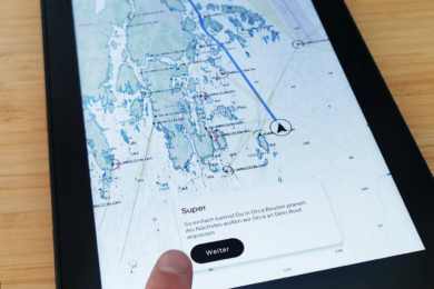
And then there is the advent of tablet and smartphone navigation, which may change everything. We have cruised with a smartphone loaded with Navionics charts and have to admit that it works very well. A tablet would be even better. See Daniel Collins’ paean to tablet nav on page 42.
Given the consolidation of off-the-shelf marine electronics and new technology that changes things every year, here are three scenarios for equipping your boat with marine electronics from the basics to carte blanche.
BASIC ELECTRONICS
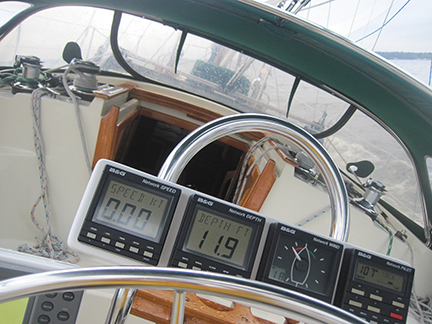
Basic marine electronics should do two things—tell you where you are and tell you what’s going on with the wind, your boat speed and the water depth. Given these simple parameters, a basic electronics system should start with a sailing instrument package that includes a masthead unit to measure wind speed and angle, and smart heads that will display the data and calculate true wind speed from apparent wind speed readings.
In this package there will have to be a speedometer to measure your boat’s speed through the water and a depth sounder that tells you how deep the water is under your keel.
With a sailing instrument package installed, you will be able to sail your boat to its optimum angles and speeds in a wide range of wind conditions. You will be able to put together a “when to reef” chart and a polar chart or graph of the most efficient sailing angles. When your boat is sailing better, you will have more fun and get where you are going faster.
A speedo will measure boat speed and distance sailed through the water, not over the ground. With this information you can run a written dead reckoning of the course, speed and distance sailed, so should you lose electricity, you will know where you are at that given moment.
To the basic sailing instruments, the obvious companion will be a GPS. You can get away with a handheld model that allows you to follow small basic charts. But in reality, a handheld unit is most effective when you use it to collect your latitude and longitude so it can be plotted on a paper chart. A handheld device will also give you speed over the bottom instead of through the water so you can easily calculate current set and drift.
These days, you can buy a small GPS chartplotter for not much more than a handheld unit and it will certainly fix your position and guide you home. Many of these smaller units also have a fish finder/depth sounder as part of the package, which gives you two important functions in one small box.
A sailing instrument package will cost about $2000, and a small, good quality GPS chartplotter will run about $800, so you can get the basics you need for safe coastal sailing and near-shore nav for less than $3000.
MID-RANGE BUDGET
If you head farther afield, say on long coastal and shorter offshore runs, you will need to have several pieces of navigational electronics that will make your trips safer and easier.
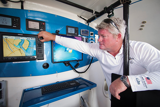
Building on the base of good quality sailing instruments, speedo and depth sounder, you will probably want to upgrade from the small, basic GPS chartplotter to a more sophisticated multi-function display (MFD) that combines data inputs and works as a master screen for the boat. The MFD will primarily be a chartplotter, but it can be much more, too.
With the chartplotter function, you will need to install digital charts for the areas you will be sailing and download updates annually. The MFD can be mounted at the chart table, but most skippers these days mount their units at the helm, either on the binnacle for a single-wheeled boat or on the aft end of the cockpit table on a twin-wheel design.
With the MFD, the next big upgrade will be a radar that feeds data to the MFD. You can use the MFD as a dedicated radar screen, you can overlay the radar data on top of the digital chart display, or you can split the screen so you have the chart image on one side and the radar image on the other. Alternatively, you can divide the MFD screen into quarters with the chart, radar, sailing instrument data and depth each in its own box—hence the MFD moniker.
The next practical item to add to the mid-range budget package will most likely be a belowdecks autopilot that will handle helming chores while you and your mate trim sails and sip cool beverages. Autopilots work incredibly well, but you need to have the right unit for your boat. Boats that are cranky and have heavy weather helms will be hard for you to steer and hard for an autopilot to handle. If that’s your case, you need to fix the helming problem before trying to steer the boat with an autopilot.
The manufacturers will offer recommendations on the size pilot to put on your boat. If your boat is at the upper end of the suggested size range or if you will be doing a lot of ocean sailing, then you should opt to move up to the next level of drive ram. And, if you are heading over the horizon for a long voyage, you really need to have a back-up pilot that can take over while you repair the main unit.
With sailing instruments costing $2000, a mid-range MFD, GPS and radar package running about $6500, and a belowdecks autopilot coming in at about $4000, the mid-range budget marine electronics system will total approximately $12,500 (not including the cost of professional installation).
CARTE BLANCHE
Without getting ridiculous, it is possible to really go wild with your marine electronics if budget is of little concern. The mid-range budget scenario gives you everything you need. Now we can move on to all of the stuff you really want.
On top of the devices in the second scenario, the first upgrade would be to the MFD. There are a lot of ways to go here, but the most common will be to opt for the largest and latest touch screen MFDs and then to install one at the helm, one at the chart table, and one either in the owner’s cabin or on deck tucked under the dodger where a watchkeeper can sit in full protection. With all of the MFDs linked, you can navigate from anywhere on the boat and keep an eye on things even when lying in your bunk.
Since the autopilot will be doing most, if not all, of the helming, upgrading to a remote control wand for the pilot will allow you to steer the boat wherever you are—again, even in your bunk.
The development of Automatic Identifications Systems for vessels has changed the business of ship avoidance at sea by a significant margin. In most of the world’s oceans, commercial vessels are required by law to carry an AIS that broadcasts on high frequency the ship’s vital information including its name, course, speed and destination. The signal is received by your AIS and the information pops up on the MFD, on top of the chart or radar images. Roll the cursor over the contact and a box containing the ship’s information opens. AIS B transmits and receives and is the choice for most sailors. There is no question that AIS can save lives.
Receiving accurate weather forecasts aboard your boat can make all the difference between a safe and unsafe passage. There are a couple of good ways to get weather offshore. The simplest and least expensive method is to use an HF SSB radio with a Pactor 4 modem and a laptop computer. Using the SailMail or WinLink radio protocols, you can send and receive emails and download GRIB files onto your laptop where you can read them with a GRIB reader. SailMail is a subscription service with HF radio towers all over the world. Winlink is a HAM radio system.
The next level takes us to an Iridium sat phone and a computer-based system such as OCENS’ WeatherNet, which has all of the functions you need to download a wide range of forecasts, current information and much more.
If you absolutely need to have full-time communication and some broadband capability, then you need to go with a dome in which you will have an Inmarsat-compatible receiver that links you directly, if somewhat slowly, to the international telephone system and the worldwide web, and thus to email, voice communication, weather and your office.
For those sailing around North America, the Caribbean and Mexico, Sirius XM Radio offers a unique satellite-based weather service that allows you to download GRIB files directly via satellite that can be read right on the screen of your MFD.
The latest and greatest gadgets to appear on the marine electronics scene are the night vision thermal imaging systems from FLIR. Mounted at the spreaders, these devices provide an amazing amount of visibility even on the darkest night. Once again, the images from the FLIR device can be viewed on your MFD or on its own dedicated screen. As the price of these devices comes down, we will see them appearing on boats everywhere.
What’s the price of the carte blanche package of marine electronics? Well, as the old folks like to say, if you have to ask, you can’t afford it. But, in ballpark numbers, a fully blown system as described could easily run to $50,000, with installation on top of that.


