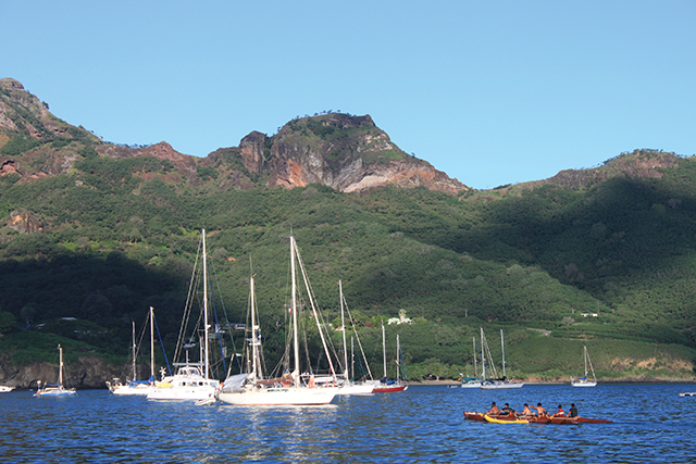
Part III: How careful planning can keep the Coconut Milk Run smooth (published December 2013)
Having sailed all the way from the Galapagos Islands to the Marquesas—3,000 miles of very open ocean—it’s easy to think of the next 770 miles to Tahiti as a mere hop. Especially when the hop is broken in two: 550-plus miles to the Tuamotus, and a mere 250 miles to Tahiti. A couple of days, nothing to it! Right?
Be warned: These passages may be relatively short, but they are not to be underestimated. Conditions west of the Marquesas are such that the weather may be considerably less predictable than that of the previous leg. Which isn’t to say that every day will be a challenge; this is, after all, the Coconut Milk Run. However, complacent sailors can easily be caught unaware and consequently report rougher passages than expected.
A case in point: We lucked into a brisk and mostly pleasant trip, whereas boats just a few days behind endured rough, squally conditions. One crew we later met in New Zealand called their Marquesas-to-Tuamotus run the worst of their entire Pacific season, with heavy seas and howling winds. Given a choice, who wouldn’t choose a pleasant journey over a trial?
CHOOSING A WEATHER WINDOW
So what exactly should you watch for when planning this passage? Track the broader Pacific weather picture carefully, paying special attention to two main factors: first, low pressure systems and associated fronts moving east from New Zealand, and second, the South Pacific Convergence Zone (SPCZ). Think of the SPCZ as the neighborhood troublemaker—you’ll want to keep an eye on its intensity and position at all times. If the SPCZ shifts south of its usual haunt at around 10 degrees south and combines with a front extending from one of those New Zealand lows, you can expect a disturbance of the trade winds and squally conditions.
Keep in mind that global forecast models, such as NOAA’s GFS GRIB forecasts, are not very good at predicting the behavior of tropical phenomena such as the SPCZ. In fact, GRIB files might show light winds when squalls of 30 to 40 knots may be on the prowl. Therefore, sailors should cull multiple weather sources, including synoptic charts and satellite imagery. (See weather resources detailed in “Atoll Cruising 101: The Tuamotus” in the May 2013 issue of BWS.) If you choose your weather window carefully, this passage will likely turn out to be the pleasant hop you’d like it to be.
PLANNING AHEAD
Every beginning starts with an end, a farewell to the land behind. For us, four weeks of blissful Marquesas cruising inevitably gave way to three days of provisioning, rig checks and fuel runs to get our 1981 Dufour 35, Namani, ready to roll. This, too, can be more of a project than it initially seems. The passage itself should only take about a week, but crews planning to spend time in the Tuamotus will easily be stocking up for a month or more. Don’t count on finding many (or any) food, fuel and water options in the Tuamotus. The good news is, the best shopping of the central Pacific awaits in Tahiti, with chandlers, grocery megastores and hardware stores.
Another plus is that all of French Polynesia is one administrative area. Once cleared into the Marquesas (see sidebar for more on the bond required of North Americans), you are clear for the Tuamotus and Society Islands as well. Sailors are technically required to check in with the local “gendarmerie” (police station) in large towns, but not in the Tuamotus. Therefore, once you notify the police, or “gendarme,” in Nuku Hiva of your departure, you’re clear until Papeete.
In addition to gathering supplies and weather data, another important consideration for this “easy” passage is arming yourself with information on the atoll passes. What are the general pass conditions for the atolls you hope to visit? Are your tide tables accurate? When will slack water be? Even the widest, deepest, “easiest” passes in the Tuamotus can make for roller coaster rides when attempted in the wrong conditions. One excellent and free resource is the wonderful Cruising Compendium for the Tuamotus compiled by the crew of S/V Soggy Paws (see sidebar).
Thinking about visiting multiple atolls? Make sure you have a realistic view of what that involves. Neighboring atolls may appear to be an easy day sail apart, but—and there’s always a “but” in the “dangerous” archipelago—even a short hop can turn into an overnighter once you factor everything in. Departing Atoll A at slack water and with the sun sufficiently high for good visibility, traveling 20 to 40 miles, then running the pass into Atoll B when slack water again coincides with good visibility. Squeezing all that into one day takes planning and a little luck. For a more thorough look at what the Tuamotus have in store, see “Atoll Cruising 101: The Tuamotus” in the May 2013 issue of BWS.
UNDERWAY AT LAST
As we set sail on a course of 215 degrees, dolphins escorted Namani away from the Marquesas, and we caught our last sunset views of the islands’ spectacular silhouettes. Steady Force 4 winds made for a pleasant broad reach and a solid 120 miles in our first twenty-four hours. We immediately slipped back into passagemaking mode, reading, watching the horizon and checking our lures for dinner.
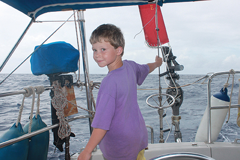
Had we not been downloading weather forecasts constantly, we might have been lulled into expecting more of the same over the entire 540 miles to Fakarava. After all, most of our month-long passage from the Galapagos to the Marquesas had been carefree, easy sailing; why expect anything different?
But the wind dropped, and a series of mild squalls set in. We reefed the sails in anticipation of each dark cloud line, only to wallow in the vacuum left when each burst passed by—an inconvenience, more than anything. As it turned out, Namani was just ahead of an unsettled patch of atmospheric conditions that made life very unpleasant, indeed, for boats just 100 miles behind. For those crews, watching the horizon was a much more urgent pastime, with endless waves of powerful squalls keeping them on their toes throughout the passage.
For us, the next days were variable in every sense: skies clearing from full cloud cover to a more pleasant quarter cover, then back again; sails in and out; motor on and off. The moon was nearly full now, lending the night watch good company. When the moon did set in the early morning hours, the effect was like turning a dimmer switch up on the rest of the stars, so brightly did they shine. The sky closed up again over day three, and much of day four was spent in a drizzle, like sailing within a wandering cloud.
Our fishing lures attracted little interest over the first part of the passage, and then suddenly drew too much interest from seabirds. Having no desire to add that type of meat to Namani’s menu, we reluctantly drew in the lines. As it turned out, those birds may well have spared us complications, as we were to find out a few minutes later.
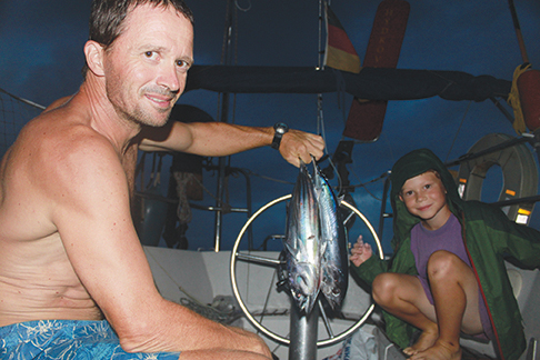
The next patch of ocean was in a wild, frothy commotion. A full feeding frenzy was on, with a tasty school of fish under attack from all directions. Birds dive-bombed into the fray from above, while large fish flashed and attacked from below. In the midst of it all, we spotted three tall, curved dorsal fins, sleek black bodies with a flash of white. A trio of huge orcas were muscling in on the feast. The fins grew closer and closer to Namani with each successive breath, until one of the orca appeared not four yards off the stern. After an alarming Moby Dick moment in which the orca had a good, close look at us as “killer whale” attack stories rushed through my mind, the giant dived and disappeared. Whew! My heart rate was slow to recover but the spectacular memory of that close encounter will last forever. When things calmed down again, we trawled the lines and came up with Namani’s all-time record catch. Three tunas struck four hooks almost simultaneously and we landed two for a delicious sashimi dinner.
THE TRANSIT OF VENUS
A more sedate, slow motion highlight of the passage was the transit of Venus. We had our protective eclipse glasses ready in anticipation of the event, but we wondered if the clouds would cooperate. As we anxiously scanned the sky, counting down the moments to the big event, we felt a close affinity to Captain Cook. Unlike him, we were not sent into the Pacific specifically to observe the transit of Venus, but like him, we were under considerable time pressure. After all, the next time Venus travels across the face of the sun will not be until the year 2117.
At the same time, the tower marking the northeast corner of Fakarava was just pulling into view. As usual, everything was happening at once. Luckily, the clouds parted enough for us to get a good look at a dark speck crawling slowly across the face of the sun. This also provided good visibility for navigating the pass of our very first atoll. By the time we ran the north pass and entered the lagoon, Venus was halfway through its transit and the sun was high overhead. A few hours later, with Namani’s anchor down off a palm-lined tropical paradise, Venus slipped off the opposite edge of the sun and continued its journey through space. We had been just in time to catch the event, just as our passage was completed in time for a nasty series of squalls to descend over the area.

ONWARD, EVER ONWARD
We opted to visit the central section of the Tuamotus, with Fakarava as a practical starting point, but many sailors stop over in Rangiroa, on the northwestern extremity of the archipelago. Others head off the beaten track to lonely atolls like Raroia or Kauehi. But sooner or later, all roads lead to Tahiti, a distance of approximately 250 miles. And this really is a hop, just two nights of downwind sailing.
This passage, too, is not without its minor challenges, but the short distance makes it feel like a walk—or a dash—through the park. Though Namani was bumped and thumped by irregular beam seas, she made good speed as yet another series of mild squalls passed overhead. Our principal preoccupation was the condition of the port aft shroud after two weary strands parted, succumbing to the strain of 20,000-plus miles of use. Spectra line worked well as a quick reinforcement, and we added one more expensive item to the “Papeete parts” list.
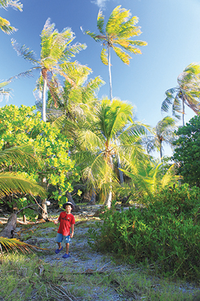 As the lights of Tahiti appeared on the horizon, so too did masthead tricolors appearing all around. The sailing fleet was re-converging after their respective exploits in the Tuamotus. When the sun rose, another sail joined the westbound gang, and another, and yet another as we rounded the northwest corner of Tahiti.
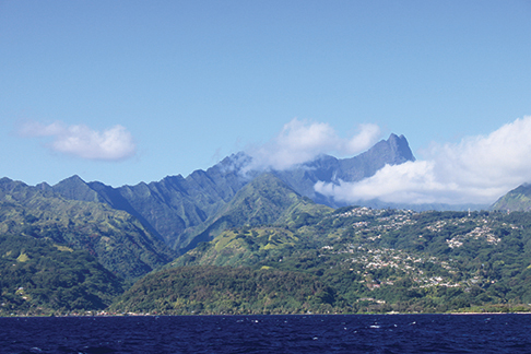
Excitement grew as we spotted Point Venus, where Captain Cook made his observations, and finally, the capital city of Papeete.
ALL CLEAR?
New arrivals have several choices of where to stay in and around the Papeete area. There are several marinas, including the public docks in downtown Papeete and the well-run Marina Taina a few kilometers south. The only catch may be to find a free berth in the peak months of June and July. A reef outlines the entire coast, but the main passes are well marked and easy to traverse. Not so with the many secondary passes, which should be treated with caution. Inside the reef is a calm, seemingly endless lagoon in which to anchor, though crowds are thick all the way past the Taina area. A limited number of rental moorings are available as well. Boats heading south from Papeete to Taina will pass the international airport, and a call on channel 12 is required to make sure you don’t tangle with low-flying aircraft (English is fine; French is appreciated, but not a must).

No matter where you tie up, you should report to the port captain in Papeete within a couple of days of arrival. The office is located in the large ferry building. While you’re at it, hoof it out to the industrial port to obtain the document needed for purchasing duty-free diesel on your way out the other end of the Society Islands. Be forewarned: This document cannot be obtained in Bora Bora.
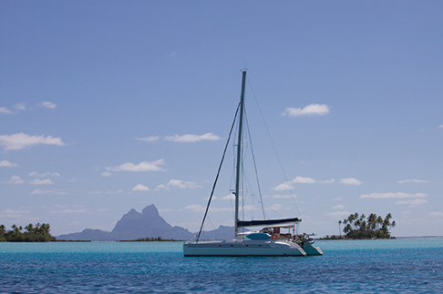
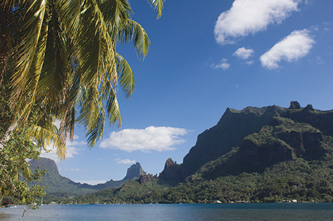
After that, business matters can be pushed to the back burner. You’re in the Society Islands at last, a place where the creature comforts of home are wrapped in stunning South Seas packaging. Tahiti is just the gateway to far greater treats, such as craggy Moorea, lovely Huahine and incomparable Bora Bora. If only the ticking clock could somehow be put on hold.
Nadine Slavinski is the author of the book Lesson Plans Ahoy: Hands-On Learning for Sailing Children and Home Schooling Sailors. Currently on sabbatical from teaching, she cruises aboard her 35-foot sloop, Namani, with her husband and young son. Her website, www.sailkidsed.net lists free resources for home schooling sailors.
CRUISING COMPENDIA FOR THE PACIFIC
Anyone cruising in the Pacific should download the excellent compendia produced by the crew of S/V Soggy Paws. Sherry and Dave McCampbell have compiled countless cruising reports from various vessels in easy-to-use PDF files. The information covers everything from pass waypoints to observations on anchorages, services, Internet coverage, dive locations and so on. The Soggy Paws compendia are available for many regions of the Pacific. There’s an entire 140 pages of detailed information in the Tuamotus Compendium alone, not to mention a wealth of information in other volumes—one each for the Marquesas, Society Islands, Cooks & Samoas, Tonga and Fiji. All are available at no charge from www.svsoggypaws.com. It’s a labor of love and an outstanding example of community service. Make sure you express your appreciation after a trouble-free cruising season by finding the modest “Buy us a Beer” tab on their site and making a donation.
THE DREADED BOND
Non-E.U. nationals are required to post a bond upon arrival in French Polynesia, a sum equivalent to the price of an airline ticket to your home country. There are a number of agents in the Marquesas and Tahiti who can facilitate the process and even obtain a bond exemption. The bond is one consideration that makes the (free) Pacific Puddle Jump rally attractive, since the organization partners with reputable agents to smooth the entry process (see www.pacificpuddlejump.com). Sailors with E.U. passports, on the other hand, can clear in to French Polynesia for three months without any fuss.


