Why we should learn to navigate (published January 2014)
If you rely solely on GPS to navigate in the fog, you will not know if it was right until the fog lifts, or until some other, maybe abrupt, event lets you know.
This is just as true navigating under clear skies in unknown waters. You do not know if you are right till you get there…or do not. If you don’t reach out of the boat for orientation and confirmation by other means, you are putting your entire navigational fate into a single piece of electronics, which is a clear violation of a major tenet of good seamanship—do not rely on any single source for navigation. Relying solely on GPS is a quintessential example of what engineers call a single point of failure.
On the other hand, GPS is usually very dependable. With all the options for backup handheld units and bags of batteries we are fairly well assured that we will usually know our latitude and longitude to a high degree of accuracy from this tool in normal circumstances.
It is prudent, nevertheless, to remain mindful of its limitations in normal circumstances, and especially in unique situations. Numerical values of our latitude and longitude, for example, will not be enough in some cases. Without a plotted position on a chart, lat-long coordinates are not much help in knowing where we really are. Even with precise lat-long values at hand, the crucial piece of navigation knowledge is usually where we are relative to landmarks or underwater hazards around us. Dependence on GPS presumes we are practiced at transferring these numerical coordinates to a valid chart, or having some echart software doing this for us on a chart we can trust is right.
The availability and quality of the charts we have is key to our dependence on GPS. In many cruising waters of the world we can end up in a small bay or inlet that is not well represented on the only chart scales available.
In the past we could say at this point that maybe the bay is shown adequately on the best chart available; we just did not have that particular chart on board. But now there is no real excuse for that. E-charts of all U.S. waters are free, and digital storage is very cheap, so there is no reason to not have all the charts available for any location. We might not choose to buy the printed versions of all of them (at about $20 each), but we should have the e-charts for such contingencies. This is essentially also true for waters of the world outside of the U.S. where e-charts are not free. The reason is, other countries or agencies selling the charts only sell them as full bundles of entire regions. The cost to buy one or two e-charts (if even an option) is the same as buying all of them for a given region.
In areas with limited charting, knowing latitude and longitude is not much help, because the chart is not much help. We must pilot these isolated waters with traditional methods that rely only on what we see and measure from the boat. We have ways to find distance off an uncharted feature, we can tell from natural ranges if we are dragging anchor, and we can map out the bay with our own depth sounder and tide books.
We should keep in mind that GPS, even where it is working fine, is not as fail-safe as we might wish. For one thing, GPS is notoriously easy to jam, either maliciously or accidentally. Google “jam GPS” or “GPS failures” and you’ll find many examples. They vary from a hacker (trying to prevent being tracked) actually shutting down an airport GPS facility he was driving by, to military exercises shutting down GPS access to large sections of the ocean for testing purposes. If you rely on your boat as a backup to doomsday, be assured that GPS will be the first thing to go in any major conflict.
But aside from this romance, the results of GPS positions and the derived data it provides must definitely be monitored. In the presence of steep cliffs the satellites can be blocked, which can at least deteriorate the accuracy if not cause complete loss of a fix. Many beautiful waterways of Alaska, for example, have such fjord-like passages. But this, too, is a specialized scenario. Modern receivers offer usable fixes with just three satellites, which are available in all but the tightest quarters, though the fixes may bounce in and out as the satellite geometry changes.
In a sense, the real risk of “relying on GPS” is not so much the GPS itself, but the full system of electronics, input power, antennas, networking, display screens and often proprietary echarts that bring us the final results. Any one of these crucial components can fail. You might push a button in and it does not come back out, and all is locked up. Or some microscopic knife nick in an antenna cable made when rerouting the cable leads to a corroded mush inside the cable in a matter of weeks of saltwater baths. Or, we rely on a computer to plot the positions and the computer crashes. (You might guess that computer experts would be less concerned about that, but indeed they will be the first to identify the computer as the weakest link in the system.)
Failures of some component of an ECS (electronic charting system) are not rare at all on a long voyage. For such long trips, backup handheld GPS units or a complete redundancy of your system is mandatory if you are going to depend on this.
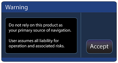
My guess is there are not nearly as many marine accidents due to actual GPS signal errors as you will find claimed in the literature. Many of these reports are more likely cockpit errors in assigning waypoints incorrectly, or simply reading some dials incorrectly, or losing power or good satellite geometry temporarily at a crucial time—or, most likely of all, the position was plotted on a proprietary echart that was in error. Nevertheless, the number of accidents due to GPS dependent operation is nowhere near zero. If it were near zero, then we would not need the warnings we get in essentially every GPS manual and start-up screen that warn us specifically to not depend on this system.
Nor would we need questions like this on the USCG license exam for deck officers:
724. Which statement concerning GPS is TRUE?
A. It cannot be used in all parts of the world.
B. There are 12 functioning GPS satellites at present.
C. It may be suspended without warning.
D. Two position lines are used to give a 2D fix.
ANSWER: C
But the question of relying solely on GPS for navigation is much more basic in the maritime world. Mariners are rightfully a very conservative group. They know that once they pull away from the dock they must be self-reliant. If you choose a life on a small boat at sea, then a fundamental rule that has been proven so many times we don’t have to go over it is you must be prepared to take care of yourself in any contingency. Murphy’s Law was invented on a small boat at sea. Anything electrical is vulnerable after some time in the salt air, especially when it is being jarred, bumped, banged, and dropped and very likely getting wet as well.
To be self-reliant, we need dependable means of navigation. A handheld GPS and spare batteries stuffed into a well-protected vacuum-sealed bag is a pretty good backup, but it is not at all bulletproof. Batteries of any kind are not perfect. One could even argue that the durability of handheld GPS units is not improving with time. They are getting cheaper, and they do have more functions, but the more they evolve toward consumer products the less dependable they become.
But we can go beyond the numerical likelihood of not having it when we need it, and look at how it affects us when we do have it. The main hazard of depending on GPS routinely is we soon lose practice at basic piloting skills, or worse still, we decide we do not need to learn these skills at all any more. In short, we forget why we are in a boat in the first place.
The history of modern civilization can be tied to the history of boats and navigation. There is a reason that all great scientists throughout recorded history devoted much of their energies to solving problems of navigation. Good navigation practice is a key to progress on an international scale and on a very local scale. Confirming our location with bearings, depth soundings, natural ranges or carrying out an accurate DR run is an intellectually satisfying experience. Relying only on our own hands and mind and basic tools like a compass and log, we accomplish something both tangible and useful. Sound navigation is a part of maritime tradition.
Besides that, learning basic navigation makes us a better mariner in a more abstract sense, because whether we show it or not, we will be anxious about our navigation if we are depending on something that we (most of us) cannot hope to understand. GPS is a black box. With nothing else to check it with, you can just hope that it works right and, again, you will only know that when you get there or do not. And when you are anxious, you are more likely to make a mistake. You risk the chance of exposing your anxiety to the crew, which could undermine your leadership, which in turn could lead to all sorts of unpleasantness. None of that will happen, of course, so long as everything is going fine, but if things start to get stressed for any reason—bad weather, broken gear—this factor will just add to the challenge.
In the long run, it is best to learn the traditional navigation skills and use them often, at least to confirm the GPS position. You will then know you can fall back to these skills for primary navigation if you need to, and that alone will make it worthwhile. If you plan to crew on other vessels, then knowing how to navigate will be an important part of your credentials and will certainly help you find a good crew position. Many skippers do not themselves believe this is necessary, but they will be happy to have someone on board who knows how to navigate.
GPS is certainly one of the most significant engineering achievements of modern times. It has, maybe more than any other single technology, dramatically influenced so many diverse activities. You can argue it is even negligent to leave the dock without it, but it is equally negligent to go to sea without knowing how to navigate in its absense. We can see this sentiment in the minds of the IMO experts who coordinate the standards for the licensing of ship’s officers worldwide. Not only do they still require an extensive demonstration of piloting and DR skills, they also require celestial navigation for ocean routes. The ongoing requirement for celestial navigation is particularly telling. Out of sight of land, celestial is the only backup to GPS, and clearly there is no authority that feels we are ready to rely on GPS without a backup.
David Burch is the director of Starpath School of Navigation, which offers online courses in marine navigation and weather at www.starpath.com. He has written eight books on navigation and received the Institute of Navigation’s Superior Achievement Award for outstanding performance as a practicing navigator.

