Some 350 boats sailed in last fall’s rallies and most of them used advanced navigation and routing systems (published January 2016)
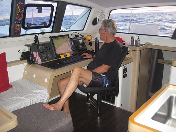
Last November, I was lucky to join Rick and Julie Palm for the passage south from Hampton, VA to the British Virgin Islands aboard their new Outremer 51 cruising cat. We were sailing with the Salty Dawg Rally (SDR)—78 boats entered—and had before us a 1,350 mile offshore passage that presents the skippers and navigators with three distinct navigational problems to solve along the way.

The first is the Gulf Stream crossing that usually is completed in the first 36 hours for most of the boats. This may be the most challenging single aspect of a passage south from the East Coast in November since the weather in the stream can turn nasty and even dangerous on very short notice. A good weather window and a plan for crossing the stream and picking up favorable eddies on the south side are key to this first phase of the passage.
The second phase is the mid-passage in what are traditionally westerlies and the transit of the Horse Latitudes that lie between the mid-latitude westerlies and the easterly trade winds. This second phase can throw all sorts of variables at the navigator, not the least being that you are out there in the likely path of any late season low or revolving storms that might form in the Caribbean or southern Bahamas. You’ve got nowhere to hide, except perhaps Bermuda, so you need to have a very good handle on the weather and have solid contingency plans should the weather make you alter course.
The third phase is the reach southward through the trade winds, starting at about 25 degrees north latitude to the Virgin Islands. In the fall, the trades can be shifty and will vary from southeast to northeast. Complicating this oscillation is the prevalence of troughs that form in the ITCZ and sag into the trades stirring up a lot of convection and creating lines of pop-up thunder squalls. You don’t want the trades blowing from the southeast since that will put you close hauled for three days. And, you certainly want to avoid heavy squalls, particularly those with lightning in them. Traditionally, professional skippers heading to the Virgins will try to sail down “route I 65”, or south along 65 degree west longitude. A waypoint at 65 W and 25 N is a good place to start when starting phase three. But, the weather will dictate your actual waypoint and strategy.
With three phases to the passage and complex current and weather systems to negotiate, how do skippers and navigators use the tools available to them to make the best possible decisions? First and foremost, how do they decide on the right weather window for the departure for the East Coast—the only weather on the trip that they can choose.
Navigators these days are using highly integrated electronics that blend sophisticated GPS and digital plotting on their multifunction displays or computers with modern communications and weather downloads through services like those provided by Ocens. All of this, in the SDR, is augmented by the excellent forecasting and routing advice provided by weather guru Chris Parker, who is sponsored for the rally by Blue Water Sailing.
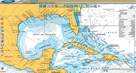
There are two approaches that navigators often take with their electronics, one relying on dedicated MFDs, such as those built by Raymarine, B&G, Navico and Furuno and those who opt for the PC or Mac computer approach that use digital charting and routing software from companies like MaxSea, Nobeltec, Fugawi and The Capn. And some, like Rick and Julie Palm who I sailed with have a hybrid combination of both.
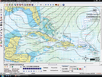
The nav system that a skipper chooses, then can be interfaced with either satellite or HF radio communications tools so he can download weather (GRIB) files that can then be overlaid onto the chartplotter screen of the computer’s digital charts.
OFF THE SHELF MFDS
Most new boats these days come with sailing instruments, autopilots and multifunction displays as part of the dealer’s package and then buyers can add to the basics with AIS, radar and a communications interface. Each brand has it strengths and weaknesses.
Navico, which owns B&G, is the largest manufacturer of marine electronics and has recently made a huge commitment to tailoring the B&G products to the specific needs of sailors and passagemakers. The basic chartplotter does all of the basic navigation you will need to make an ocean crossing, but with the Sail Steer function added or even the more sophisticated Race Panel to manage waypoints, you can get a lot of great routing data that will help you find the best sailing angles and factor in the effects of set, drift and ocean currents.
B&G doesn’t integrate weather data such as GRIB files, so you will have to capture that information on a PC or simply use the weather you get from a weather router by voice or email and apply it to your routes.
Raymarine offers a full chart plotting function with all of the bells and whistles for laying out routes and planning voyages. The Voyage Planner software that you can load onto a laptop and take home from the boat is a good way to plan routes and cruises in your spare time. The routes then can be uploaded into the MFD via Bluetooth when you are back on the boat.
Raymarine has an exclusive deal with Sirius Radio for weather downloads from their satellite array. The GRIB data can be downloaded directly onto the MFD where you can scroll through up to seven days of forecasts. This function turns your Raymarine MFD into a useful weather routing tool.
Furuno has partnered with digital software companies MaxSea and Nobeltec to deliver an extremely powerful digital charting, route planning and passagemaking suite of tools. This is the system we used aboard the Palm’s 51 foot Archer. The Furuno chartplotter was mounted at the helm in the cockpit with the sailing instruments and autopilot. This ran the standard Furuno chartplotting software.
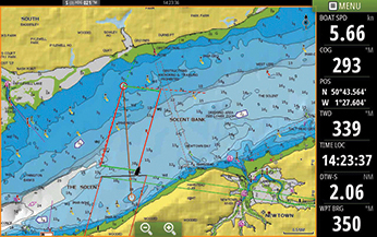
But, on the chart table, there was a powerful PC linked to the Furuno chartplotter running the full version of MaxSea in which we could perform a wide range of charting, plotting and routing functions. With weather data available through MaxSea, we were able to download either NFS or European Model forecast files for whatever region of the world we happened to be sailing in. For the route from Virginia to the BVI, we could focus solely on that data and use the seven day forecasts to plot out routes. In fact, MaxSea plots suggested routes to use from the supplied weather data. Over the course of the passage south through the three phases of the trip the MaxSea weather data was as good as anything we have ever used. Nobeltec is a sister company and has the same relationship with Furuno and provides similar if slightly more user friendly functions.
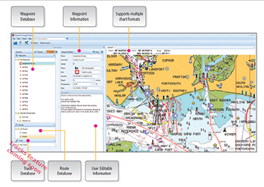
Fugawi is a smaller software company that has developed an easy-to-use and versatile chartplotting software suite that appeals to both coastal and offshore navigators. The Fugawi Global Navigator edition has all the tools you need to pilot courses and strategize routes for a passage with that in the SDR. The program interfaces with Raymarine’s Voyage Planner, so you can do a lot of route planning remotely.
Using X-Traverse, the Fugawi program allows you to overlay raw GRIB data to the onscreen chart so you can then watch how the weather is forecast to change for up to seven days ahead.
The Capn is the oldest digital chart program for PC and Mac and has a loyal following in the coastal commercial fleets and among experienced voyagers. The software is robust and fairly simple and does not have a way to overlay weather files or integrated route planning files containing GRIB files.
If you are starting from scratch, then you can design a navigation system that suits your needs and pocketbook. Many of us are starting with some basic electronics that we have either got as part of the package with a new boat or as the legacy electronics on a brokerage boat.
Either way, if you’re planning to sail in a rally like the SDR or the Baja Haha in California, then you will want to find a way to integrate your charting and navigation functions with all of your instruments and then have that system have the capability to download weather files and forecasts while you’re on the high seas.

