Here are the charts and guides you need to safely navigate and cruise the Caribbean (published January 2014)
Every fall hundreds of boats depart the East Coast for the Caribbean. Bermuda Harbour Radio estimates that as many as 1,100 boats make the passage south each year, and all of them need charts, pilots, light lists and cruising guides. While most of us use modern chartpotters with digital charts and have handheld GPSs as backup, it is still vital for every skipper and navigator to carry paper charts and supporting references, and to be able to navigate across a large body of water without the chartplotter.
There are still some intrepid navigators who carry a sextant as a backup and they should be applauded for their thorough preparation and for having bothered to learn how to take sights, calculate a solution and then plot it accurately on a chart while maintaining a running DR fix. But most of us today rely on GPS almost exclusively.
PAPER CHARTS
Even though you will mostly be using digital charts on your voyage, either in a dedicated chartplotter or a laptop with navigation software loaded, you really need to think of the chartplotter as a convenience and your paper charts as your primary navigation tools.
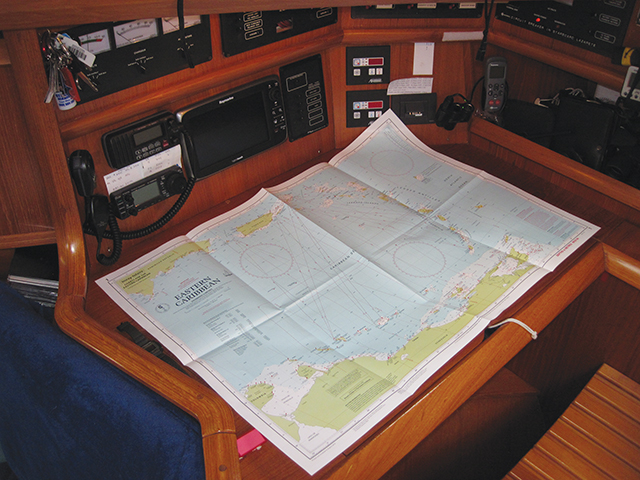
For offshore work, we find it easier to lay courses on a large ocean routing chart than on the small screen of the chartplotter or laptop. On a paper chart you can highlight any dangers out there in a bright color, lay on the Gulf Stream coordinates and the waypoint where you want to cross it, and even make notes in pencil about currents and weather.
The Plan A charts are your ocean routing charts and the detailed charts for the Caribbean islands that you will be visiting plus those you might visit. The Plan B charts are for your likely bail out options should you need to change your plans and your route for any reason. Be certain that plans do change and you may need to make safe landfalls off your intended route all along the way. For boats departing from the Chesapeake, you need to have U.S. Coastal charts north to Boston and south to Miami. And you need charts of the Bahamas, Turks & Caicos, and all of the Virgin Islands.
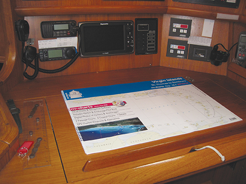
Purchasing all of these paper charts can get expensive if you buy them individually. Bound chart kits or chart books are the solution. For the U.S. coast and the Bahamas, Richardson’s Chart Kits work very well. For the Bahamas and Turks & Caicos, old Bahamian hands favor the Explorer chart kits. And for Bermuda and the Caribbean, the new NV Chart kits from Germany are the best solution.
Once in the Caribbean, it is good to have a wide selection of charts from Laurie, Norie & Imray since these charts are updated regularly by actual cruisers and are generally more accurate than charts derived from government surveys. The charts are printed on water resistant paper, too.
Storing all of these charts can be a problem. You can tuck chart kits under bunk cushions where they will stay dry and flat. Individual charts can be rolled and stowed in water proof tubes; but, you want to have the charts you will be using for the near future unrolled and stowed flat in the chart table or under a seat cushion in the saloon.
DIGITAL CHARTS
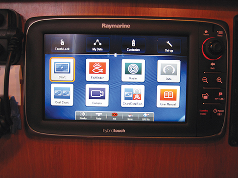 There are two good options for navigating in the digital age by using either a dedicated multifunction display such as your chartplotter, or by using a laptop or tablet equipped with a GPS receiver and loaded with a chart reading program and your library of charts.
Dedicated multi function displays (MFDs), some now with touch screens, have really evolved into navigational and sailing command centers. The big name brands, Raymarine, Brooks & Gatehouse, Simrad, Furuno and Garmin all work as chartplotters, radar displays, weather displays and displays for all of the data you are collecting from your radar, AIS, wind, speed and depth sensors.
The charts you use in your MFD will most likely be from Navionics or C-Map with Navionics owning the lion’s share of the sailing market. C-Map and Navionics cartridges work in all leading MFDs with the exception of Garmin units, which only use the Garmin Blue Chart & Map Source chart files. When choosing the brand and level of charts for your MFD, be careful to get all of the charts you need and the detail you want.
Laptop navigation has been around since the dawn of the PC. Programs like The CapN, Nobeltec, MaxSea, Fugawi, MapTech and others have evolved over the years and are now capable of performing a wide range of navigational chores and include vast amounts of data that is useful to navigators. These programs contain tide and current charts, light lists, and tons of items of local knowledge for harbors around America and the world. The digital chart companies have all created chart libraries for the various digital chart readers so you will have a good selection of charts to choose from.
It should be noted that NV Charts, which is primarily a paper chart publisher, includes a CD with their chart kits that has a simple digital chart reader on it and all of the charts in the chart book in digital format.
With tablets and smart phones becoming almost ubiquitous, companies like Navionics have jumped in and created digital charts and apps that transform these devices into hand held chart plotters. And, with Bluetooth capability built into the latest MFDs, you can also use your tablet to operate your MFD remotely, say from the comfort of your warm bunk on a cold night.
GPS and radar, linked to digital charts and the devices that have evolved to read them and navigate, have changed navigation forever. It says something that the U.S. Naval Academy has stopped teaching celestial navigation and NOAA has announced that it will cease publishing paper charts, leaving that job to private entrepreneurs.
CRUISING GUIDES
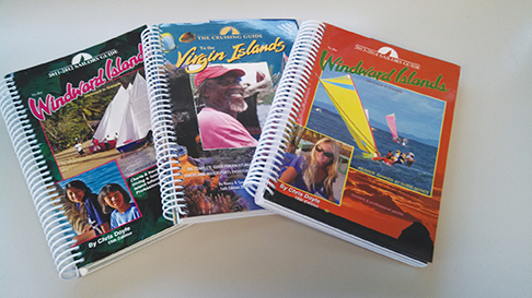 Don Street is the father of the original cruising guides to the Caribbean and his guides are still available through certain dealers and online. Street is a sailor’s sailor who spent many years cruising the islands aboard his ancient engineless yawl Iolaire. So, the guides include a lot of interesting detail for all of us who cruise under sail and like to really explore the islands beyond the confines of the most popular harbors. The four books cover the islands from Puerto Rico to Trinidad.
Cruising Guide Publications publishes a very comprehensive collection of cruising and sailing guides to the whole Eastern Caribbean. These ring bound books have excellent harbor charts and are chock full of useful information for anyone cruising the islands from the Spanish Virgins in the north to Trinidad and Tobago in the south.
If you load up with all of the paper charts mentioned above, plus digital charts for your MFD and laptop, and all of the cruising guides, you will sink your boat by an inch or more. But, once you get down to the islands and start exploring, you will be very glad you have so much useful information readily at hand.
CHART AND GUIDE SOURCES
LandFall Navigation www.landfallnavigation.com (A one-stop shop for everything you will need.)
Captain’s Nautical Supplies www.captainsnautical.com
Richardson’s Chart Books www.richardsonscharts.com
Explorer Chart Kits www.explorercharts.com
NV-Charts www.nvcharts.com
Cruising Guide Publications www.cruisingguides.com
Navionics www.navionics.com
C-Map www.jeppesen.com
Garmin Blue Cats www.garmin.com

