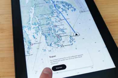
Weather Services International has introduced a weather and tides app for the iPad and iPhone that delivers much of the information that professional meteorologists would get at their workstations, but it is geared to mariners and presented as overlays on NOAA charts — a first.
“We are the tool that TV weather forecasters use,” says Linda Maynard, spokeswoman for Weather Services International, one of The Weather Channel’s business units. “It is high-quality data specifically tooled for boaters’ needs.”
The Intellicast Boating App is geared to coastal cruisers, weekend anglers, ferry operators, harbormasters, water-based EMS technicians and other inshore mariners in the continental United States, Alaska, Hawaii, Puerto Rico, the Bahamas, the Caribbean and parts of Mexico and Canada. It receives data via cellular or Wi-Fi connections, so it operates only in the broadcast range of those technologies.
The introduction of NOAA charts in the electronic weather displays is by popular demand, according to Maynard. “When we did our research on what folks really like, they said we have two separate things — the charts and the weather information. They don’t come together. It would be really helpful to get them together,” she says.
The charts are not for navigation but strictly for background for weather information overlays, and the volume of information at the mariner’s fingertips with this app is impressive. “We’re giving the boater a lot of functionality, a lot of information, a lot of data,” Maynard says. “We wanted to make it a rich user experience.”
Weather and tide information are available for user-defined ports of call or for the user’s current location. The data include Doppler weather radar graphics depicting storm systems; satellite data showing fog and clouds; radar forecast graphics depicting the projected movement of storms; wind speed; air and water temperatures; buoy and C-Man (Coastal-Marine Automated Network) platform observations; National Weather Service marine forecasts; and NWS severe weather alerts, including tornadoes and flooding, and hurricane and tropical storm warnings, watches and tracks from the National Hurricane Center in Miami.
The app also displays 48-hour tide tables; 10-day forecasts; times for sunrise, sunset, moonrise and moonset; UV forecasts; and an almanac of historical weather information.
Intellicast’s iPhone app costs $9.99, and the iPad app costs $14.99; they are available for download at www.intellicast.com. Maynard says the apps are more costly than others because they carry no advertising — again reflecting the preferences of boaters whom Weather Services International surveyed in its market research. “They told us, ‘Please stop combining the information with advertising,’ “ she says. “That comes at a price. We’ll see if people put their money where their mouth is.”
Weather Services International estimates the potential market for the apps at around 12 million — the number of registered boats in the United States. Maynard says the company is eyeing an Intellicast Boating App for the Android platform, but “that depends on how well this is received. à It is a valuable tool that you can use over and over and over again.”
Courtesy of www.soundingsonline.com


