
Browsing Tag NOAA
-
Dock Talk 0
Charting Changes: NOAA’s Plans for the Future of Charts
Have you ever wondered why your depth sounder and chart do not agree on the suitability of a planned anchorage, or why all of the charts you have ...
-
Dock Talk 0
Do You Need a New Chart?
NOAA privatized printing of paper nautical charts in 2014 and, in the ensuing years, focused on modernizing chart compilation and production. Those recent changes allow us to update ...
-
Dock Talk 0
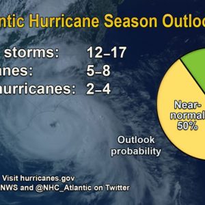
Updated Analysis Suggests Atlantic Hurricane Season to be Stronger than Expected
In its updated 2016 Atlantic Hurricane Season Outlook, NOAA calls for a higher likelihood of a near-normal or above-normal season, and decreases the chance of a below-normal season ...
-
Dock Talk 0
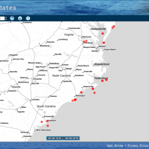
NOAA Uses Crowdsourced Data to Improve Charts
The United States has about 3,400,000 square nautical miles of water within our coastal and Great Lakes jurisdiction. Coast Survey, who is responsible for charting that vast area, ...
-
Dock Talk 0
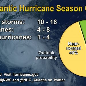
NOAA Predicts Near-normal Atlantic Hurricane Season
NOAA’s Climate Prediction Center says the 2016 Atlantic hurricane season, which runs from June 1 through November 30, will most likely be near-normal, but forecast uncertainty in the ...
-
Dock Talk 0
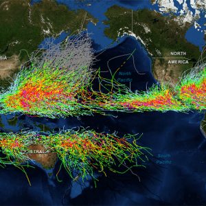
NOAA’s Historical Hurricane Tracks
NOAA’s Historical Hurricane Tracks is a free interactive online tool that allows users to track historic hurricane tracks. The site, developed by the NOAA Office for Coastal Management ...
-
Tech Talk 0
How Accurate are Nautical Charts?
NOAA announces that charts will provide more information on “zone of confidence”. It is a major challenge – some might say an impossibility – to keep all thousand ...
-
Dock Talk 0
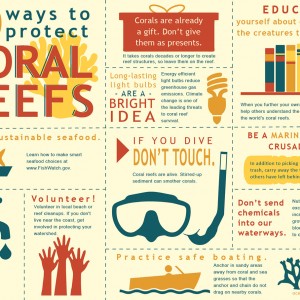
How Everyone Can Protect Coral Reefs
Even if you live far from coral reefs, you can have an impact on reef health and conservation. Coral reefs play a vital role in sustaining the health ...
-
Cruising Green 0
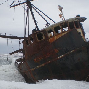
NOAA’s Marine Debris Program
Alaska, the largest and most remote state in the United States, is filled with wilderness and beauty-and unfortunately with marine debris. With a longer coastline than all ...
-
Dock Talk 0

Evolution of Tide Tables Over the Last 150 years
Tide predictions are a major part of life for coastal communities in the United States. Commercial and recreational boaters who live, work, and recreate on the coast use ...

Recent Posts


Please Visit Our Sponsor’s Webpages


