
Browsing Tag navigation
-
Just Cruising with George Day 0
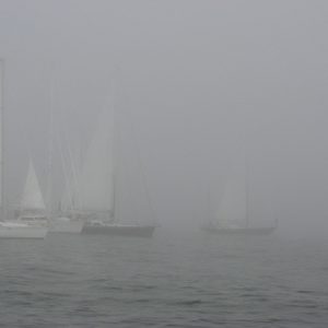
Foggy Days Along the Coast
Spring and early summer are the foggy months along our coastlines and in the Great Lakes. It has to do with warm air flowing over cold water to ...
-
Mindbender 0

Mindbender
What are the primary currents that makeup the North Atlantic Gyre? Send your answers to cruisingcompass@bwsailing.com. A winner will be selected randomly from the correct answers and ...
-
Dock Talk 0
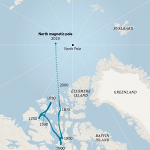
The North Magnetic Pole Is on the Move
The North Pole right at the top of the planet remains fixed in place as the earth spins around its axis but the location the North Magnetic Pole ...
-
Dock Talk 0
Garmin Buys ActiveCaptain: Should Be Good News for Cruisers
It would be hard to find a serious cruising person who, at one time or another, has not turned to ActiveCaptain for help. I know I have, and ...
-
Dock Talk 0
Charting Changes: NOAA’s Plans for the Future of Charts
Have you ever wondered why your depth sounder and chart do not agree on the suitability of a planned anchorage, or why all of the charts you have ...
-
Dock Talk 0
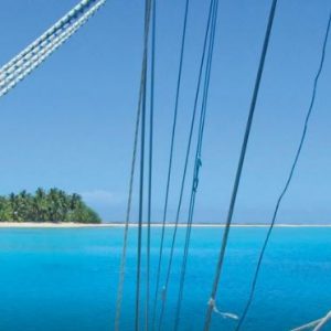
Reef Navigation Using Satellite Images
Many atolls and reef areas have only sketchy charts or are entirely uncharted. Of course, reef navigation means a great deal of eye-ball navigation – regardless of chart ...
-
Boat Rat's Tip of the Week 0
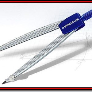
Use a Plotting-Compass for Fast Sailing Navigation
By Captain John of skippertips.com. Not many sailing navigation instruments top this one. Use it one handed to plot GPS latitude and longitude, find a position with radar ...
-
Tech Talk 0
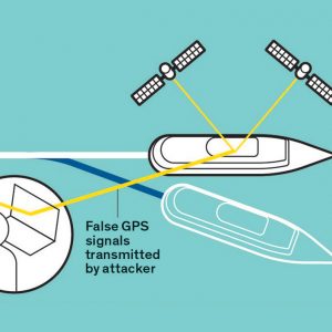
Protecting GPS From Spoofers Is Critical to the Future of Navigation
Just hours before U.S. president Barack Obama delivered his final State of the Union speech in January, two U.S. Navy patrol boats wandered into Iranian waters. The Iranian ...
-
Boat Rat's Tip of the Week 0
Could Your Navigation Skills Use a Tune-up?
By Captain John of skippertips.com. Nothing beats GPS for fast, reliable sailing navigation. But will that be enough to ensure that you sail clear of those “ship-killing” reefs ...
-
Boat Rat's Tip of the Week 0
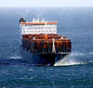
How to Avoid a Ship’s Blind Spot
Captain John of skippertips.com has a important reminder about navigating safely around container ships. This ship’s freeboard (distance from deck to waterline) combined with her stacked containers creates ...

Recent Posts

Please Visit Our Sponsor’s Webpages


