
Browsing Category Tech Talk
-
Dock Talk 0

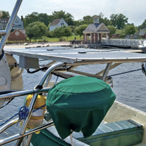
Is the New CayCube a Better Mouse Trap?
We’ve been in dozens of cruiser gatherings –in cockpits, on beaches, in raft ups—and inevitably at some point the discussion –among men particularly—turns to the issue of on-board ...
-
Dock Talk 0
In-Depth Guide to Building a Solar Charging System for Your Boat
Solar panels have long been the best passive solution for keeping your boat’s batteries topped up and many of us have gone through the process of doing an ...
-
Dock Talk 0

Zoleo Provides the Simplest Satellite, Cellular and Wi-Fi Comms Worldwide
In the last two years, Zoleo has made great inroads with the cruising community and for good reason. For example, when the Salty Dawg Rally organizers decided to ...
-
Dock Talk 0
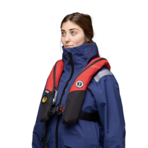
Mustang Introduces Award Winning Atlas PFD That Does It All
Mustang Survival’s latest inflatable PFD, the Atlas 190 DLX Hammar incorporates everything the highly respected marine safety company has learned about PFDs over the last four decades. This ...
-
Dock Talk 0
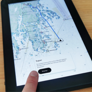
The Nav System to Replace Chart Plotters?
Many of us who have dedicated chart plotters on our boats or multifunction displays (MFDs), also have charting and routing apps on out phones and tablets that we ...
-
Boat Reviews 0

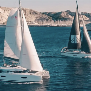
Innovative, Recyclable and Award-Winning Weekender from Grand Soleil
After spending three days at the Cannes Yachting Festival in France last September and meeting with the leaders of the major boat building companies, including Group Beneteau, Hanse ...
-
Dock Talk 0

Mustang Introduces New Hydrostatic Offshore Inflatable PFD
Mustang has long been a leader in marine safety gear and inflatable personal flotation deveices so it is news when the company comes out with a radical news ...
-
Boat Reviews 0
Fountain Pajot-Dufour Yachts Group Makes Commitment to Carbon Neutrality by 2030
The Fountain Pajot-Dufour Yachts Group, based in France, has become one of the largest builders of sailing yachts, multihulls and monohulls, in the world. They also have made ...
-
Dock Talk 0
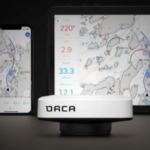
Orca 2 Nav System Expands Capabilities
The Orca satellite and chart plotter system designed for tablets and smart phones to replace the integrated systems from Garmin Raymarine and others, has been around for two ...
-
Tech Talk 0
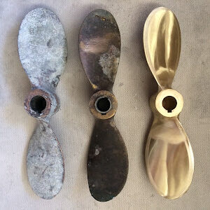
Replacing a Sailboat’s Propeller
Captain Curran onboard a 1976 Newport 30 shows how to replace a propeller. He explains the process of first checking for oxidation and corrosion, removing the old propeller, ...
- 1
- 2
- 3
- …
- 23
- Next Page »


Please Visit Our Sponsor’s Webpages


